Residential Zoning by Race:
How Pittsburgh’s Zoning Districts Promote Different Housing Options for Black and White Residents
Part 2: Pittsburgh’s Zoning History
by Carolyn Ristau
Pittsburgh’s Zoning History
Residential Zoning by Race uses three of the maps from Pittsburgh’s 100 years of zoning to trace and analyze the development of the single-family and multi-unit zoning districts.
Pittsburgh adopted its first zoning ordinance in 1923. All residential areas at that time permitted a variety of housing types.
In 1926, the US Supreme Court ruled that exclusive single-family zoning districts were constitutional. The rational was that the single-family dwelling, and those that lived there, needed to be protected from the polluting influences of the following:
•Industrial factories
•Businesses
•Apartments
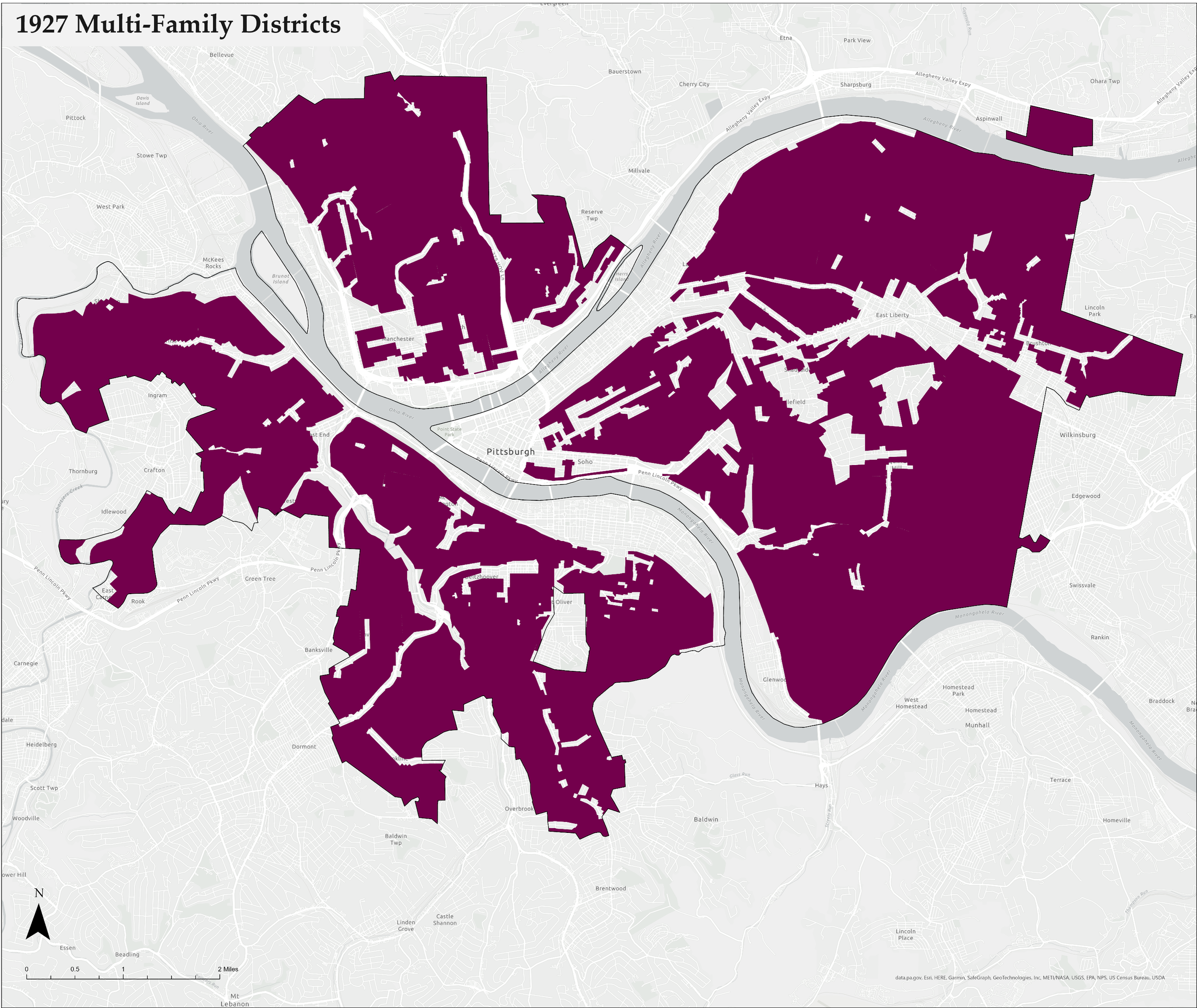
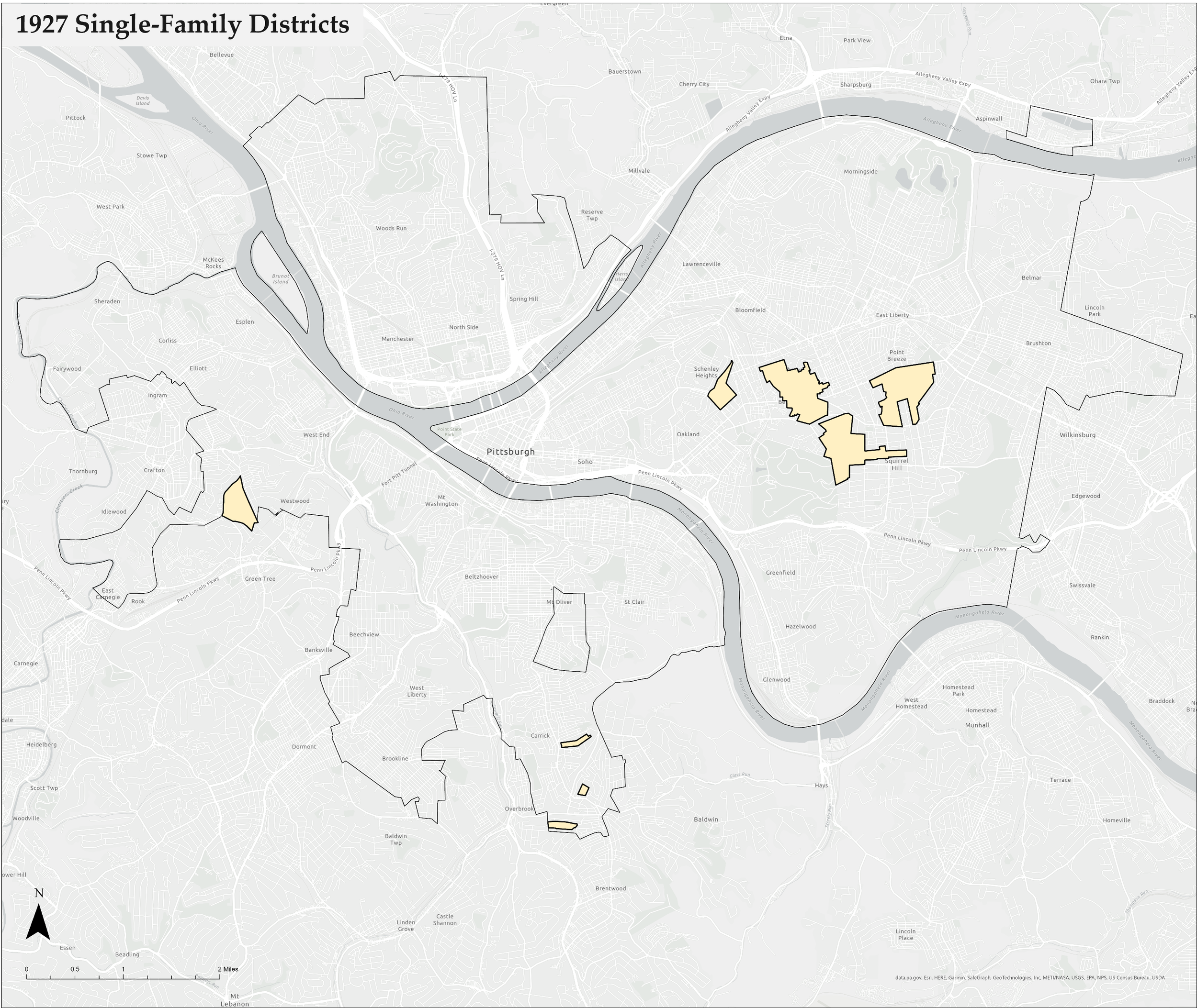
While the Supreme Court was writing its decision, Pittsburgh’s City Council was writing and voting on a zoning amendment to add an exclusive single-family zoning district. The new map with this district was issued in 1927 and is pictured here.
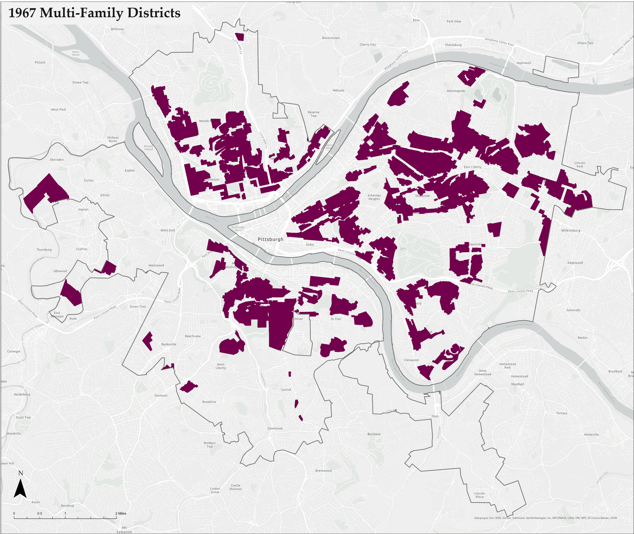
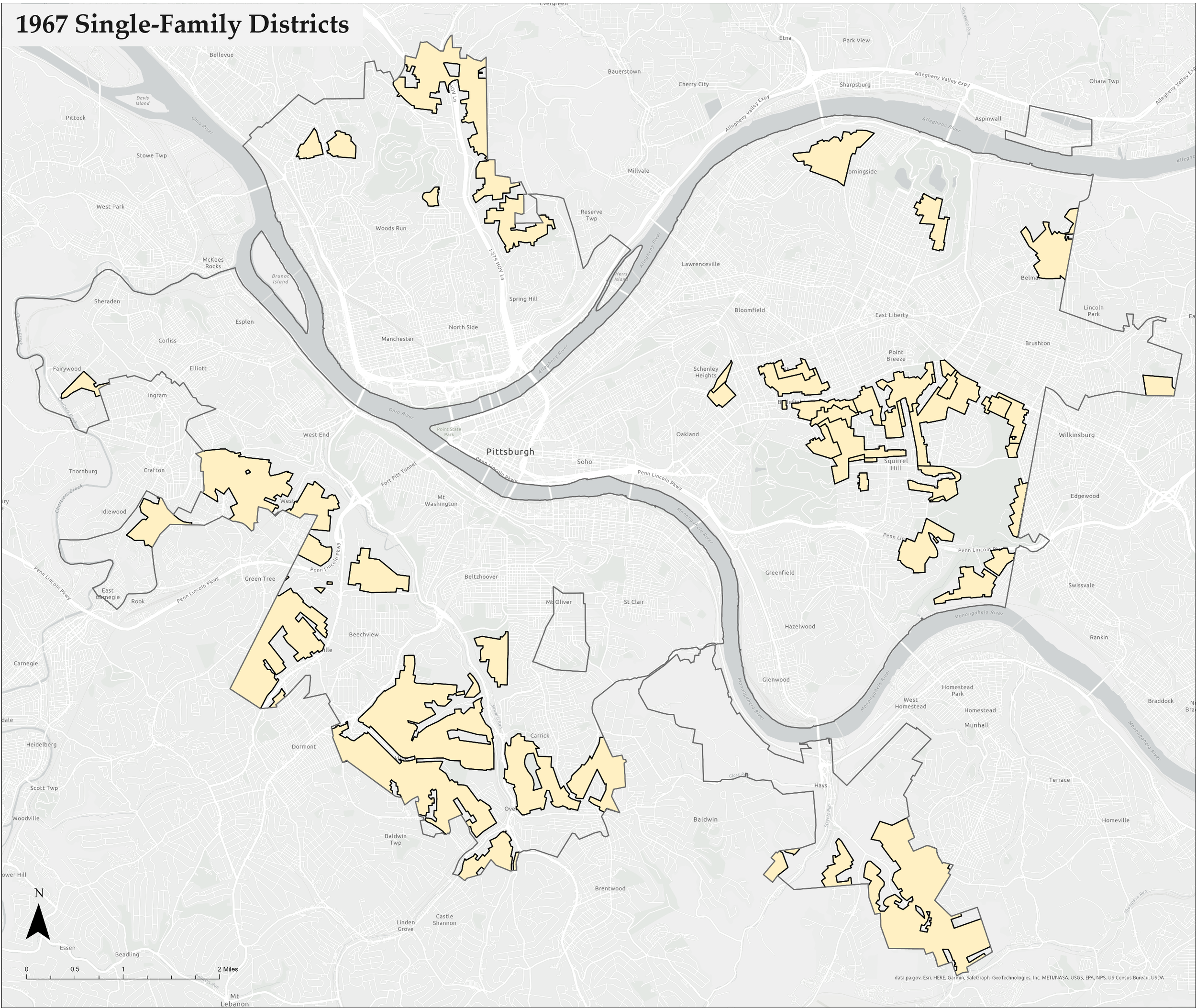
In 1958, Pittsburgh replaced its 40-page pamphlet zoning ordinance with a 200+ page book. This was the birth of modern zoning in the city. A new zoning map was issued at that time. At the time of this research, the 1958 map was not available. The next available zoning map from 1967 (shown here), is used as a proxy. The zoning districts on this map substantially match the districts identified in the 1958 code suggesting that the 1967 map is substantially similar to the 1958 map.
The new map shows that in addition to adding pages of regulations, the zoning districts became more nuanced, with numerous districts in each of the categories of residential, commercial, and industrial. In addition, the exclusive single-family zoning district grew between 1927 and 1967.
The changes in Pittsburgh’s zoning from 1927 to 1967 may have been influenced in part by policies at the federal level. This period covers the era when the federal government began to subsidize the building of masses of single-family dwellings across the country after World War II. In addition, federal funding for transportation, disaster recovery, and other issues was often tied to conditions that required zoning.
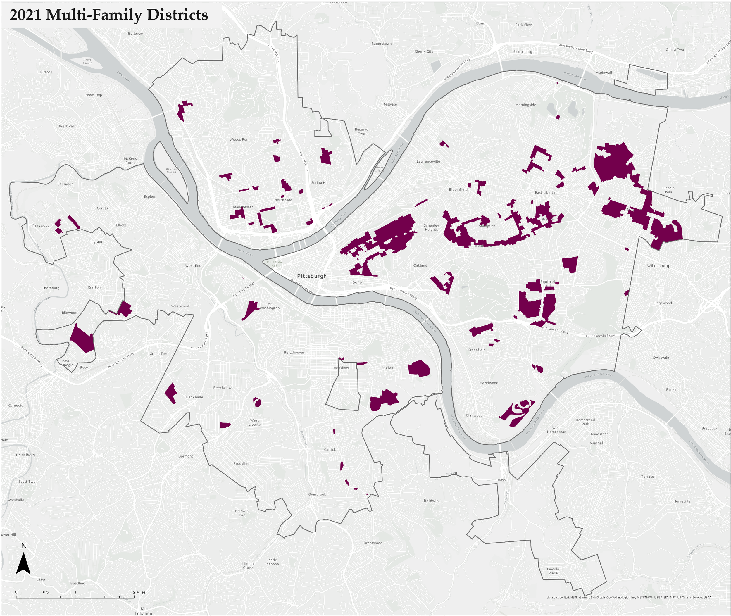
By 2021, Pittsburgh adopted several more zoning text and map amendments. The exclusive single-family zoning district continued to expand across the city, while the areas that permit multi-unit residential buildings diminished. The zoning text became more complex, and the number of total zoning districts increased again as shown in the map pictured here.
Below are two series of maps that highlight the growth of the single-family zoning district and the contraction of the multi-family zoning district across the three zoning maps.
Single-Family Zoning District Expansion 1927-2021

Multi-Family Zoning District Contraction 1927-2021
