
Pittsburgh Zoning Districts - UPR-A Overview
By Kathleen Oldrey
Introduction
Zoning districts are a fundamental building block of zoning regulations and set the base use, height, and density standards for the area they cover. In some cases, the district also sets the required level of zoning review. Pittsburgh has over 50 distinct mapped zoning districts. This series of guides is unpacking each of these districts.
In this post, we provide an overview of the UPR-A (Uptown Public Realm Subdistrict A: Mixed-Use Urban Core) zoning district. Additional posts dive into the use and density regulations for the UPR-A and provide an overview of the full UPR, the other subdistrict: UPR-B, and the performance points system.
Refer to our Introduction to Pittsburgh’s Zoning Districts for the complete list of base zoning districts in the city. Pittsburgh’s interactive zoning map can be used to verify the project site’s zoning district.
Overview
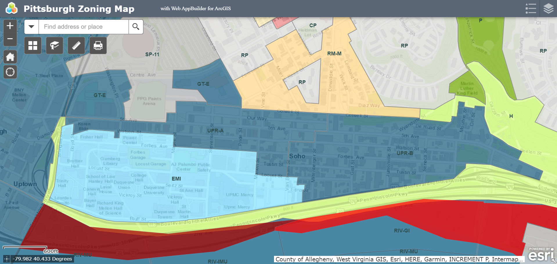
The UPR-A (Uptown Public Realm Subdistrict A: Mixed-Use Urban Core) zoning district covers 0.05 square miles or 0.10% of Pittsburgh and is roughly located along Fifth Avenue between I-579 and Dinwiddie Street. In places, the UPR-A extends as far north as Colwell Street and as far south as Locust Street. It borders areas zoned EMI, H, GT-E, SP-11, and RM-M.
Challenges
The purpose statement of the UPR-A identifies increasing density and adaptive reuse as development priorities for this subdistrict. It also calls for more active uses such as shops and restaurants on ground floors, with other uses above.
Like the UPR as a whole, the UPR-A prioritizes sustainability. Large buildings or additions are required to join the Pittsburgh 2030 District, a program with a commitment to promoting sustainability in the built environment. Large parking garages must include three or more elements from a curated list of renewable energy, sustainable waste management, and alternative transportation strategies to be eligible as a use permitted through a Special Exception.
The UPR-A subdistrict includes areas of potential Steep Slope Overlay, and a small area of Landslide-Prone Overlay. It is also located entirely within a Registered Community Organization (RCO) area; projects that meet or exceed the RCO thresholds may be required to undergo additional public processes.
Conclusion
As a public realm subdistrict, additional public processes may be required for large-scale projects in the UPR-A subdistrict. While the presence of environmental overlay areas such as Steep Slope and Landslide-Prone Overlays is relatively limited, depending on the scope and details of a project, additional documentation and review may be required to ensure compliance with the UPR’s and UPR-A’s code requirements related to sustainability, design, and urban form.