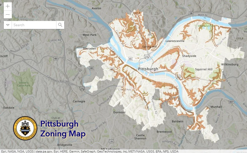
Pittsburgh Zoning Map - Landslide Prone Layer
By Carolyn Ristau
Introduction
Pittsburgh’s interactive zoning map includes many layers besides the zoning districts, most of which relate to requirements within or adjacent to the zoning code. For an overview on how to use the interactive zoning map, see our introductory post.
To select different layers, click the stack of paper in the upper right corner. The layers available are listed below. Today’s post features the landslide prone layer, pictured above and in bold text below.
Zoning
Zoning Districts
Zoning Districts Outlines
Zoning Max. Height Overlay
Height Reduction Zone Overlay
1500’ Major Transit Buffer
Parking Reduction Areas
North Side Commercial Parking Prohibited Area
Baum Centre Zoning Overlay
Inclusionary Housing Overlay District
RCO (Registered Community Organization) Areas
City Divisions
DPW Divisions
Neighborhoods
Council Districts 2012
Council Districts 2022
Wards
Historic Preservation
Mexican War Street Historic Boundary
Individual City-Designated Properties
Pittsburgh City Historic Districts
Environment
RIV Riparian Buffer (125 Feet)
Stormwater Riparian Buffer
Floodplain Areas
Landslide Prone
Potential Steep Slopes Overlay Area
Undermined Areas
Addresses
Allegheny County
City Boundaries
Imagery 2021
The Landslide Prone Layer
Overview
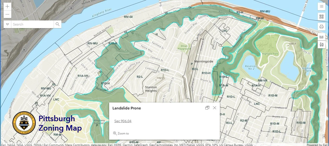
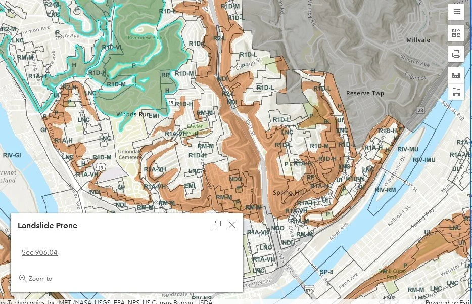
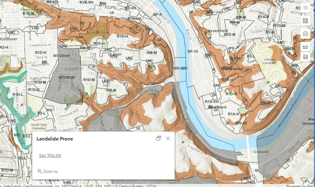
This layer of the interactive zoning map shows areas of the city with soil conditions prone to landslides. When the landslide prone layer is clicked, the pop-up box confirms that the point clicked is in the layer and links to the zoning code section that discusses the landslide prone regulations, which are copied below.
Relationship with Zoning
Additional requirements may apply to projects within the landslide prone layer. These regulations are in the Environmental Overlay Districts chapter of the Zoning Code (Chapter 906).
906.04. - LS-O, Landslide-Prone Overlay District.
906.04.A Purpose
The LS-O, Landslide-Prone Overlay District regulations require subsurface investigations by a registered professional and approval of construction plans by the Chief of the Bureau of Building Inspection prior to issuance of a Certificate of Occupancy for any development in the LS-O District. The purpose of these regulations is to reduce the risk of damage or hazards of life that may occur as a result of construction and land operations on lands susceptible to movement or sliding of earth.
906.04.B.2 Review by the Zoning Administrator
No Certificate of Occupancy application shall be approved for zoning for any structure or for any use of land requiring excavation, fill or removal of vegetation until the applicant has submitted evidence, acceptable to the Zoning Administrator, that the proposed construction or development shall not contribute to or create conditions of increased susceptibility to landslides, soil erosion or any other movement of earth. Such evidence shall be based on field investigation performed by a registered professional as defined in the Land Operations Ordinance or a geotechnical consultant with appropriate professional insurance certification and the appropriate academic credentials and professional association.
906.04.B.3 Review by the Chief of the Bureau of Building Inspection
No building permit or land operations permit application shall be approved for any structure or for any use of land requiring excavation, fill or removal of vegetation in a Landslide-Prone District until construction plans and land operations plans for the site in question have been approved by the Chief of the Bureau of Building Inspection, based on findings and recommendations of the site investigation required under Sec. 906.03.B.2. In the implementation of this requirement, the Chief of the Bureau of Building Inspection may require that construction and land plans be prepared or approved by a registered professional as defined in the Land Operations Ordinance or a geotechnical consultant with appropriate professional insurance certification and the appropriate academic credentials and professional association.
Language like “evidence acceptable to the Zoning Administrator” provides administrative leeway in applying these regulations. According to the Zoning Office’s website, acceptable evidence is either a full geotechnical report or documentation from “a certified geotechnical professional that the proposal will not increase the susceptibility of landslides on the subject property or surrounding property.” The full geotechnical report is required for any application for new construction or for a multi-story addition. The documentation from a certified geotechnical professional, which could be a letter, applies to any application for a parking pad, deck, porch, stoop, balcony, retaining wall, or one-story addition.
Note: the code is a bit outdated regarding staff titles: the Chief of the Bureau of Building Inspection is now the Director of the Department of Permits, Licenses, and Inspections (PLI).
Challenges
The ambiguous language can make it challenging to prepare the proper documentation ahead of time for a project in the landslide prone layer. The guidance on the website provides some clarity, but there is still the potential that site-specific conditions will prompt either zoning or PLI staff to ask for additional information after reviewing the application materials.
Conclusion
Start with Pittsburgh’s interactive zoning map to check if your project is within a landslide prone area. If it is and it involves new construction or one of the other application types listed above, make sure that there is a certified geotechnical professional on your project team. Also, add extra time and money for the geotechnical professional to create the appropriate documentation and for the zoning and PLI staff to review it. Additional money may be needed to implement the measures identified by the geotechnical professional to ensure that the project will not increase the site’s or surrounding properties’ susceptibility to landslides.


