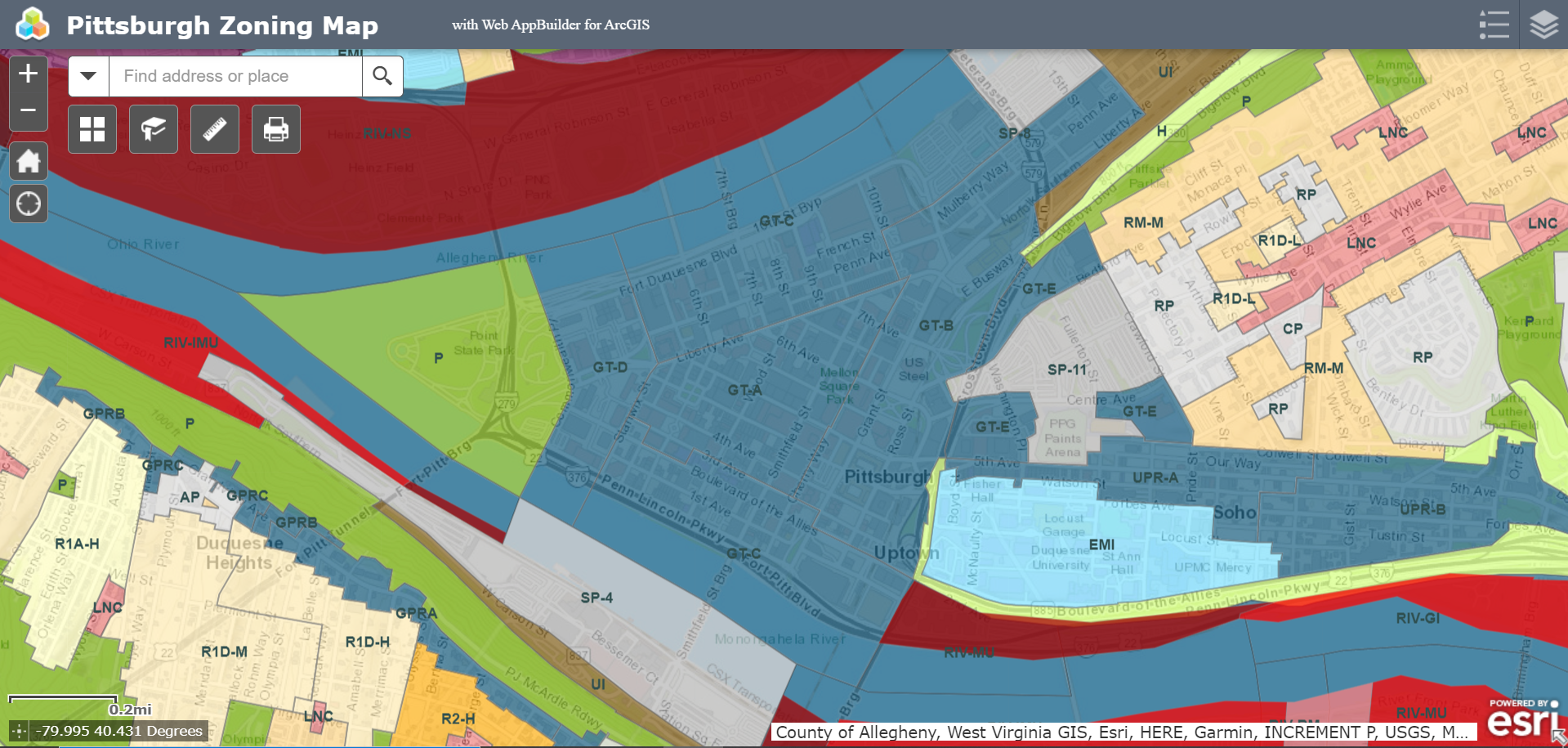
Pittsburgh Zoning Districts - GT Overview
By Kathleen Oldrey
Introduction
Zoning districts are a fundamental building block of zoning regulations and set the base use, height, and density standards for the area they cover. In some cases, the district also sets the required level of zoning review. Pittsburgh has over 50 distinct mapped zoning districts. This series of guides is unpacking each of these districts.
In this post, we provide an overview of the GT (Golden Triangle) zoning district. Later posts will cover permitted uses in the Golden Triangle, as well as overviews and density regulations of the five subdistricts: GT-A, GT-B, GT-C, GT-D, and GT-E.
Refer to our Introduction to Pittsburgh’s Zoning Districts for the complete list of base zoning districts in the city. Pittsburgh’s interactive zoning map can be used to verify the project site’s zoning district.
Overview
The GT (Golden Triangle) zoning district covers 0.71 square miles or 1.46% of Pittsburgh and is currently Pittsburgh’s only designated Downtown district. Roughly bounded by Point State Park, the Allegheny River, I-579, Crawford Street, and the Monongahela River, the GT zoning district boundaries are mostly, but not totally, consistent with the boundaries of the Central Business District neighborhood. The GT zoning district shares boundaries with the Parks, SP-8, Urban Industrial, Hillside, Multi-Unit Residential (Moderate Density), Residential Planned, and SP-11 zoning districts.
The regulations for the GT zoning district are found in chapter 910 of Pittsburgh’s zoning code. Several specific requirements apply across the GT zoning district, including requirements for general and urban open space, light access, and electronic signage. In some circumstances, floor area bonuses can be available with the inclusion of additional open space, transit facilities, or first-floor retail uses. If approved by the Planning Commission via the conditional use process, density or intensity transfers between lots within the GT zoning district may also be available.
Challenges
Similar to process requirements in the public realm districts (GPR, OPR, and UPR), proposed development in the GT can be subject to review by Planning Commission; projects that do not require review by Planning Commission are those where:
all proposed exterior work has a cost of less than $50,000; or
the proposed development consists of only interior work that does not create any new dwelling units.
Planning Commission review requires documentation beyond what is required for a basic zoning review, as well as presentation of the project at two Planning Commission meetings. There is an additional fee for this level of review. Most, but not all, of the GT area is located within one or more Registered Community Organizations (RCOs) areas, and thus are also subject to RCO process requirements if those thresholds are met.
In addition to the RCO areas, parts of the GT are impacted by other overlay districts. Two city historic districts are located within the GT: the Penn-Liberty Historic District and the Market Square Historic District. Much of the GT falls within a 1500’ Major Transit Buffer, as well as within a Parking Reduction Area that reduces the off-street parking requirement for all uses by 100%.
Areas of the GT that are near the Allegheny and Monongahela Rivers may fall within the floodplain and are located in the 75’ Riparian Zones, which will need to be taken into account on projects that require stormwater management. Relatively small and scattered areas of the GT are also within Landslide-Prone and Potential Steep Slope Area Overlays.
Conclusion
While it shares some review levels and processes with public realm districts like the UPR and OPR, the Golden Triangle has unique additional standards, and the cost and development scope thresholds for review by Planning Commission are relatively low, which means most projects will require additional documentation and time. RCO and historic areas may also require additional public meetings and application materials.

